Pixel8
Making 3-d maps together
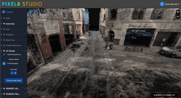
Many parallel efforts are underway to map the world in photorealistic 3-D. Tech giants like Apple and Google have an early lead but startups that leverage commodity hardware and crowdsourcing are pioneering faster, smarter, cheaper approaches. Colorado-based Pixel8 (now part of Snap) recruited a community of volunteer surveyors to scan cities with 360 degree GoPro cameras, which they convert to 3D point cloud and mesh maps. This data is released under a “maps for humans are free” and “maps for machines are for fee” business model.
This points towards an evolution of models for big open maps like Open Street Map from a simple commons to a more nuanced exchange of value between users and privately held curators.
Source: pixel8earth.medium.com
Sector
Built Environment & Real Estate
Urban Science
Tags
imagery
sensing
GIS
3D
open data
crowdsourcing


..png)
